Definition of Flood Plains
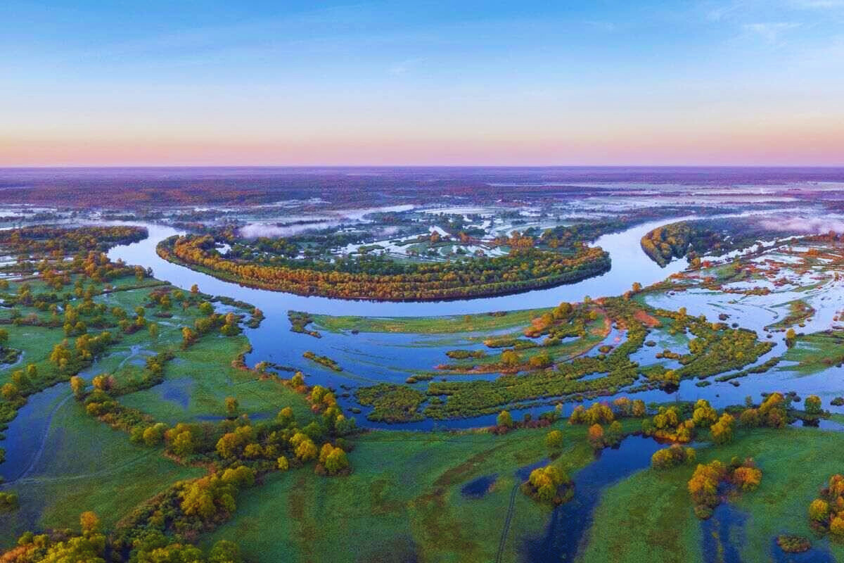
Flood plains are expansive, flat lands adjacent to rivers or water bodies that experience periodic flooding. Understanding how these areas form is crucial for managing and mitigating the associated risks.
Formation Process
Natural Factors Contributing to Flood Plain Formation
Flood plains, those expansive and flat landscapes adjacent to rivers, are intricately shaped by various natural factors. Understanding these elements is key to unraveling how floodplains are formed.
1. River Discharge and Sediment Deposition
Rivers play a pivotal role in floodplain formation. The process begins with the discharge of water from upstream regions. As the river flows, it carries sediments—particles of soil, rocks, and organic matter. When the river’s velocity decreases upon reaching a flatter area, it can no longer transport the sediment, leading to deposition. This sediment accumulation over time contributes significantly to the formation of flood plains.
2. Topography and Basin Characteristics
The topography of the surrounding land plays a crucial role in determining the extent and nature of floodplain formation. Regions with gentle slopes or low-lying areas are more prone to developing flood plains as water spreads out and deposits sediments. Additionally, the characteristics of the basin, such as its size and shape, influence how water and sediments are distributed, further shaping the floodplain landscape.
3. Rainfall and Seasonal Variation
Climate and rainfall patterns have a direct impact on floodplain formation. Intense or prolonged rainfall can increase river discharge, contaminating sediment transport and deposition. Seasonal variations, such as monsoons, can result in periodic flooding, gradually expanding the floodplain areas. The cyclical nature of these weather patterns plays a vital role in shaping the dynamic features of flood plains.
4. Vegetation and Erosion Control
Vegetation along riverbanks and in surrounding areas plays a dual role in floodplain formation. On one hand, the roots of plants help stabilize the soil, preventing erosion. This allows sediment to settle, aiding in floodplain development. On the other hand, the presence of vegetation can influence the speed and distribution of water, affecting sediment transport and deposition. The intricate relationship between vegetation and soil dynamics contributes significantly to the formation of flood plains.
5. Natural Channel Patterns
The natural patterns of river channels also influence floodplain development. Meandering rivers, characterized by winding and curving channels, contribute to the deposition of sediments on the inner bends, creating expansive flood plains. Braided rivers, with multiple interconnected channels, also foster sediment deposition, contributing to the growth of floodplain areas.
Understanding these natural factors provides a glimpse into the complex and dynamic processes that give rise to flood plains. Nature’s engineering, as showcased through river systems and climatic patterns, plays a fascinating role in shaping these unique landscapes over time.
Human-Induced Factors Affecting Flood Plain Development
While nature plays a significant role in the formation of flood plains, human activities have become powerful influencers, shaping these landscapes in profound ways. Understanding the human-induced factors contributing to floodplain development is essential for comprehensive insights into this intricate relationship.
1. Urbanization and Infrastructure Development
As populations grow, urban areas expand into flood-prone regions, altering the natural landscape. The construction of buildings, roads, and other infrastructure can disrupt the natural flow of rivers and change the dynamics of flood plains. Impermeable surfaces like pavement reduce water absorption, leading to increased runoff and a higher likelihood of flooding.
2. Dam Construction and Reservoirs
The construction of dams and reservoirs is a deliberate human intervention that impacts floodplain development. Dams alter river flow patterns, holding back water and sediment. This can reduce downstream sediment deposition, affecting the growth of flood plains. At the same time, controlled releases from dams can lead to abrupt flooding events downstream, influencing the extent and character of flood plains.
3. Agricultural Practices and Land Use Changes
Human reliance on flood plains for agriculture has been a historical constant. However, modern agricultural practices often involve extensive land modification. The clearing of vegetation, the use of drainage systems, and the alteration of natural watercourses can disrupt the delicate balance between river dynamics and floodplain formation, influencing the landscape over time.
4. Deforestation and Soil Erosion
Deforestation, driven by agricultural expansion or logging, contributes to soil erosion and sedimentation. When forests are removed, the protective cover provided by vegetation is lost. This results in increased runoff, leading to accelerated soil erosion. The transported sediments can impact river channels and flood plains, altering their natural state.
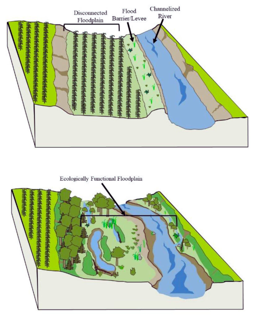
5. River Channelization and Flood Control Structures
In an attempt to manage and control flooding, humans often channelize rivers or erect flood control structures like levees and embankments. While these interventions can protect specific areas from immediate flooding, they can also alter the natural processes of sediment transport and deposition. The confinement of rivers may lead to increased erosion in some areas and reduced sediment deposition in flood plains.
6. Climate Change Mitigation Measures
Efforts to mitigate climate change, such as afforestation or the creation of green spaces, can indirectly affect floodplain development. While these measures aim to sequester carbon and regulate climate, they may inadvertently impact local hydrological patterns, influencing the natural processes that contribute to floodplain formation.
Understanding the human-induced factors shaping flood plains is essential for sustainable development and risk management. Balancing the needs of growing populations with environmental considerations is crucial to maintaining the delicate equilibrium between human activities and the dynamic processes that define floodplain landscapes.
Geographical Features
Characteristics of Areas Prone to Flood Plain Formation
Flood plains are not randomly distributed; specific characteristics make certain areas more prone to the formation of these dynamic landscapes. Recognizing these features provides valuable insights into the vulnerability of regions to floodplain development.
1. Low-lying Topography
Areas with low-lying topography are more susceptible to floodplain formation. The gradual descent of the land allows water to spread out, facilitating sediment deposition and the creation of expansive flood plains. The flatter the terrain, the more likely it is to develop flood plains as rivers meander through the landscape.
2. Proximity to Rivers and Water Bodies
The proximity of an area to rivers and water bodies is a primary determinant of floodplain formation. Regions located along the banks of rivers or near large water bodies are at an increased risk. The interaction between river systems and adjacent low-lying areas creates the conditions conducive to the growth of flood plains.
3. High Sediment Transport Potential
Areas with high sediment transport potential are more likely to develop floodplains. Rivers carrying substantial amounts of sediment deposit these materials when their flow velocity decreases. This sediment accumulation over time contributes to the fertile soils characteristic of flood plains.
4. Flood Frequency and Intensity
Regions experiencing frequent and intense flooding events are prone to floodplain formation. The cyclical nature of floods, driven by seasonal variations or climatic conditions, contributes to the deposition of sediments and the expansion of flood plains. Understanding the historical flood patterns is crucial in identifying areas at risk.
5. Dynamic River Systems
Dynamic river systems characterized by meandering or braided channels contribute to floodplain development. Meandering rivers create intricate patterns of sediment deposition, forming expansive flood plains on their inner bends. Braided rivers, with multiple interconnected channels, also foster sediment accumulation, shaping the landscape into flood plains.
6. Soil Permeability
Soil permeability plays a role in floodplain formation. Areas with permeable soils allow water to infiltrate more easily, reducing the risk of flooding. Conversely, impermeable soils hinder water absorption, leading to increased runoff and a higher likelihood of floodplain development.
7. Climate and Rainfall Patterns
Regions with specific climate and rainfall patterns are more prone to floodplain formation. Intense or prolonged rainfall can increase river discharge, promoting sediment transport and deposition. Understanding the climatic conditions influencing an area provides valuable information about its susceptibility to floodplain development.
8. Historical Floodplain Presence
The historical presence of floodplains in an area is a strong indicator of its predisposition to floodplain formation. Once flood plains are established, they tend to persist over time, subject to the ongoing interplay of natural and human-induced factors.
Recognizing these characteristics allows for a more nuanced understanding of the factors influencing floodplain development. This awareness is crucial for effective land-use planning, risk mitigation, and sustainable development in regions prone to the formation of flood plains.
Importance of Flood Plains
Ecological Significance of Flood Plains
Flood plains are not just flat expanses prone to periodic flooding; they are vibrant ecosystems with profound ecological significance. Understanding the ecological role of flood plains unveils the intricate web of life that thrives in these dynamic landscapes.
1. Biodiversity Hotspots
Flood plains are biodiversity hotspots, supporting a rich variety of plant and animal species. The periodic flooding and nutrient-rich sediments contribute to fertile soils, fostering the growth of diverse vegetation. This, in turn, creates habitats for a multitude of species, from insects to birds and mammals.
2. Nutrient Cycling and Soil Fertility
The cyclic inundation of flood plains plays a crucial role in nutrient cycling. As rivers overflow onto flood plains, they deposit nutrient-rich sediments, replenishing the soil. This natural fertilization supports lush vegetation, providing essential habitats for various organisms and enhancing overall soil fertility.
3. Habitat for Aquatic Life
Flood plains serve as critical habitats for aquatic life. During floods, fish and other aquatic organisms find refuge in the flooded areas. As water recedes, these species move back into the river channels, contributing to the overall biodiversity of the river ecosystem.
4. Wetlands as Buffer Zones
Wetlands, often integral components of flood plains, act as natural buffer zones during flooding events. They absorb excess water, reducing the severity of floods and minimizing the impact on surrounding areas. Wetlands also serve as filtration systems, purifying water as it passes through, benefiting both the ecosystem and downstream communities.
5. Migration Routes for Wildlife
Flood plains often act as migration routes for wildlife. Birds, in particular, may utilize floodplains during their seasonal migrations. The availability of food resources and suitable resting places makes flood plains essential for maintaining the health and diversity of migratory species.
6. Floodplain Forests and Riparian Vegetation
Floodplain forests and riparian vegetation thrive in the unique conditions of floodplains. These ecosystems provide essential habitats for a variety of species, including insects, birds, and small mammals. The diversity of plant life contributes to the overall resilience and adaptability of floodplain ecosystems.
7. Natural Flood Control
Flood plains play a crucial role in natural flood control. By absorbing and slowing down floodwaters, they help regulate the flow of rivers, reducing the risk of downstream flooding. This natural flood control mechanism benefits both the ecosystem and human communities living downstream.
8. Cultural and Recreational Value
Beyond their ecological importance, flood plains hold cultural and recreational value. People have historically settled along flood plains, relying on the fertile soils for agriculture. Additionally, flood plains often serve as recreational spaces, providing opportunities for activities like birdwatching, hiking, and photography.
Understanding the ecological significance of flood plains emphasizes the importance of preserving and managing these ecosystems sustainably. Balancing human needs with the conservation of these dynamic landscapes is crucial for maintaining biodiversity, supporting healthy ecosystems, and ensuring the continued ecological resilience of flood plains.
Agricultural Benefits of Flood Plains
Flood plains, often seen as potential risks due to periodic flooding, also offer substantial agricultural benefits. These dynamic landscapes, enriched by the natural processes of flooding, have been harnessed for centuries to support agriculture and contribute significantly to food production.
1. Fertile Soil Composition
One of the primary agricultural benefits of flood plains is the fertility of the soil. The periodic inundation of the land with nutrient-rich sediments carried by rivers enriches the soil composition. This natural fertilization process results in fertile and productive soils, ideal for various crops.
2. Nutrient Renewal
The cyclic flooding of flood plains serves as a natural mechanism for nutrient renewal. As rivers overflow onto the plains, they deposit organic matter and minerals, replenishing the soil. This continuous renewal of nutrients supports the sustained growth of crops, reducing the reliance on artificial fertilizers.
3. Moisture Retention
The flat topography of flood plains facilitates moisture retention in the soil. The water absorbed during flooding events is stored in the soil, creating favorable conditions for crop growth during dry periods. This moisture-retaining capacity enhances the resilience of agricultural activities in floodplain regions.
4. Diverse Crop Cultivation
The combination of fertile soil and ample water supply supports the cultivation of a diverse range of crops. Flood plains are suitable for growing various staples, including rice, wheat, and vegetables. This diversity in crop cultivation contributes to food security and allows farmers to adapt to changing market demands.
5. Extended Growing Seasons
Flood plains often experience longer growing seasons due to the favorable soil and moisture conditions. This extended period allows for multiple crop cycles in a year, enhancing overall agricultural productivity. Farmers in floodplain areas can capitalize on these prolonged growing seasons to maximize their yields.
6. Natural Irrigation
The periodic flooding of flood plains serves as a natural irrigation system. The inundation of fields helps distribute water evenly, eliminating the need for extensive artificial irrigation infrastructure. This natural irrigation not only saves on water resources but also reduces the costs and environmental impact associated with irrigation practices.
7. Traditional Floodplain Farming Practices
Many cultures have developed traditional farming practices specifically suited to flood plains. For example, paddy fields, commonly found in flood-prone areas, are designed to hold and control water levels, allowing for the cultivation of rice—a staple in many regions. These time-tested practices highlight the adaptability of agriculture to floodplain environments.
8. Rich Biodiversity Supporting Agriculture
The diverse ecosystems of flood plains, including wetlands and riparian areas, contribute to a rich biodiversity. This biodiversity can have positive spillover effects on agriculture by promoting natural pest control, pollination, and overall ecosystem balance. The interplay between agriculture and biodiversity enhances the sustainability of farming practices.
Understanding and harnessing the agricultural benefits of flood plains requires careful management and sustainable practices. Balancing the advantages of fertile soil and natural irrigation with the challenges of periodic flooding is essential for ensuring the long-term viability of agriculture in these dynamic landscapes.
Historical Significance
Examples of Civilizations Influenced by Flood Plains

Throughout history, various civilizations have flourished along the fertile banks of rivers and flood plains. The interaction between these dynamic landscapes and human societies has shaped the course of history, contributing to the development of advanced cultures and civilizations. Here are notable examples of civilizations profoundly influenced by floodplains:
1. Mesopotamia (Tigris and Euphrates Rivers)
Often referred to as the “cradle of civilization,” Mesopotamia, situated between the Tigris and Euphrates Rivers, owes its prosperity to the fertile flood plains. The annual flooding of these rivers deposited nutrient-rich sediments, creating fertile soil ideal for agriculture. Mesopotamian civilizations, including the Sumerians and Babylonians, developed sophisticated irrigation systems and established some of the world’s earliest cities.
2. Ancient Egypt (Nile River)
The Nile River, with its predictable annual flooding, played a pivotal role in the development of Ancient Egypt. The flooding of the Nile brought nutrient-rich silt, providing fertile soil for agriculture. Egyptians mastered the art of irrigation and created an intricate network of canals to maximize agricultural productivity. The Nile’s influence extended beyond agriculture, shaping the religious, cultural, and economic aspects of Egyptian civilization.
3. Indus Valley Civilization (Indus River)
The Indus Valley Civilization, one of the world’s oldest urban cultures, thrived along the floodplains of the Indus River. The predictable monsoon rains and flooding of the river facilitated agricultural activities. Sophisticated urban planning, advanced drainage systems, and a strong emphasis on agriculture were key features of this ancient civilization, showcasing the close relationship between human settlement and floodplain resources.
4. Ancient China (Yellow River and Yangtze River)
China’s ancient civilizations, particularly along the Yellow River and Yangtze River, were heavily influenced by the fertile flood plains. The periodic flooding of these rivers deposited nutrient-rich sediments, supporting agriculture. The Chinese developed intricate systems of terraced farming and flood control, enabling the sustainable use of floodplains and contributing to the rise of powerful dynasties.
5. Sumerians in Mesopotamia
The Sumerians, one of the earliest urban societies, were heavily reliant on the flood plains of the Tigris and Euphrates Rivers. They built intricate canal systems to manage water flow and developed a sophisticated agricultural system. The surplus food production allowed for specialization in other fields, leading to advancements in art, literature, and governance.
6. Harappan Civilization (Indus River)
The Harappan Civilization, also known as the Indus Valley Civilization, thrived along the flood plains of the Indus River. The cities of Mohenjo-Daro and Harappa were meticulously planned, and agriculture played a central role in their economies. The utilization of the Indus River’s resources, including its flood plains, contributed to the prosperity of this ancient civilization.
These examples illustrate the profound impact of floodplains on the development of civilizations. The fertile soils, natural irrigation, and strategic location of flood plains have consistently provided the foundation for the growth of advanced societies, leaving a lasting legacy in the pages of human history.
Ecological Impact
Biodiversity and Ecosystems Within Flood Plains
Flood plains are not only characterized by their potential for flooding but are also rich and diverse ecosystems that support a wide array of flora and fauna. The unique combination of periodic inundation, fertile soil, and varied habitats creates a dynamic environment that fosters biodiversity and sustains intricate ecosystems.
1. Riparian Vegetation and Wetlands
Flood plains often host riparian vegetation along riverbanks and expansive wetlands. These areas act as crucial habitats for a diverse range of plant species adapted to periodic flooding. Species like willows, sedges, and various grasses thrive in these conditions, contributing to the overall biodiversity of floodplain ecosystems.
2. Aquatic Species and Fish Migration
Flood plains play a vital role in supporting aquatic biodiversity. During flooding events, water spills over into floodplain areas, creating temporary habitats for fish and other aquatic organisms. This inundation allows for fish spawning and contributes to the lifecycle of various species. Additionally, flood plains serve as essential migration routes for fish, enhancing overall aquatic diversity.
3. Bird Habitats and Migratory Patterns
Flood plains are renowned for their significance in bird habitats. The diverse vegetation, wetlands, and availability of food resources attract a multitude of bird species. Many birds, including waterfowl and shorebirds, utilize flood plains for nesting, feeding, and resting during migration. The seasonal inundation provides optimal conditions for the proliferation of insects, a vital food source for many bird species.
4. Insect and Invertebrate Diversity
The fertile soils of flood plains support a rich diversity of insects and invertebrates. The inundation and subsequent drying create dynamic habitats, promoting the breeding and flourishing of numerous species. These small organisms play crucial roles in nutrient cycling, pollination, and serving as a food source for higher trophic levels within the ecosystem.
5. Terrestrial Mammals and Adaptations
Flood plains provide habitats for terrestrial mammals adapted to dynamic environments. Species like deer, beavers, and rodents are well-suited to navigate the fluctuating water levels and find refuge in the diverse vegetation of flood plains. The interconnectedness of terrestrial and aquatic ecosystems within flood plains contributes to the overall resilience of these mammalian populations.
6. Plant Adaptations to Flooding
Vegetation within flood plains has evolved specific adaptations to cope with periodic flooding. Some plant species have developed buoyant seeds that can float and disperse during floods. Others exhibit tolerance to waterlogging and can survive inundation. These adaptations contribute to the overall diversity of plant life within floodplain ecosystems.
7. Biodiversity Hotspots and Conservation Importance
Flood plains are recognized as biodiversity hotspots due to the concentration of diverse species and unique ecological interactions. The conservation of floodplain ecosystems is crucial for preserving biodiversity, as these areas support a delicate balance of interconnected species. Conservation efforts focus on maintaining the integrity of flood plains and mitigating human-induced threats.
Understanding the intricate biodiversity and ecosystems within flood plains emphasizes the importance of sustainable management and conservation practices. The dynamic nature of these environments requires a holistic approach that considers the interdependence of various species and the resilience of floodplain ecosystems in the face of environmental changes.
Case Studies
Notable Flood Plain Formations and Their Impact
Flood plains, shaped by natural processes and human activities, have witnessed the formation of notable landscapes with far-reaching impacts. From ecological transformations to human settlements, these floodplain formations have left enduring imprints on the world. Here are examples of significant floodplain formations and their consequential impacts:
1. Mississippi River Delta, USA
The Mississippi River Delta stands as a prime example of a vast floodplain formation with profound ecological and geological consequences. The river’s continuous sediment deposition has led to the creation of expansive wetlands and marshes. This deltaic ecosystem is not only a biodiversity hotspot but also serves as a crucial storm surge buffer, providing natural protection to coastal areas.
2. Sundarbans, Bangladesh and India
The Sundarbans, formed by the confluence of the Ganges, Brahmaputra, and Meghna rivers, is the largest mangrove forest in the world. This floodplain formation not only supports diverse ecosystems but also acts as a natural barrier against storm surges and tidal waves. The Sundarbans are home to the Bengal tiger and numerous other species, showcasing the intricate relationship between flood plains and biodiversity.
3. Danube River Floodplains, Europe
The flood plains of the Danube River have been instrumental in shaping the cultural and agricultural landscapes of Central and Eastern Europe. These flood plains have historically provided fertile soils for agriculture, supporting vibrant communities. However, the management of these flood plains is critical due to the potential for flooding, and ongoing efforts balance agricultural needs with conservation and flood control.
4. Nile River Floodplain, Egypt
The annual flooding of the Nile River has played a pivotal role in the agricultural practices of ancient and modern Egypt. The nutrient-rich sediments deposited during flooding have sustained agriculture for millennia. The construction of the Aswan High Dam has altered the natural flood patterns, impacting the traditional agricultural practices and ecosystems of the Nile floodplain.
5. Mekong River Delta, Vietnam
The Mekong River Delta is a dynamic floodplain formation that supports one of the world’s most productive rice-growing regions. The delta’s intricate network of channels and fertile soils contributes significantly to Vietnam’s agricultural output. However, the delicate balance between sediment deposition and river management is crucial to sustaining the productivity of this vital floodplain.
6. Rhine River Floodplains, Germany and Netherlands
The Rhine River floodplains have witnessed extensive human intervention to manage flooding and promote sustainable land use. Levees, embankments, and controlled flooding contribute to the protection of settlements and agricultural areas. However, the impact of these interventions on natural ecosystems and biodiversity underscores the complex challenges of balancing human needs with ecological preservation.
7. Okavango Delta, Botswana
The Okavango Delta is a unique floodplain formation where the river’s waters fan out into a sprawling inland delta. This dynamic system sustains diverse habitats, supporting a rich array of wildlife. The seasonal flooding creates a pulsating ecosystem, attracting migratory species and showcasing the delicate interplay between flood plains and biodiversity.
These notable floodplain formations demonstrate the multifaceted impact of these landscapes on ecosystems, human societies, and global biodiversity. The management and conservation of these areas require a nuanced approach that considers the intricate balance between natural processes, human activities, and the preservation of these dynamic floodplain formations.
Human Adaptation
Strategies for Living in Flood-Prone Areas
Living in flood-prone areas demands thoughtful planning and resilient strategies to mitigate the risks associated with periodic flooding. From adaptive infrastructure to community preparedness, implementing effective measures is essential for the safety and well-being of residents. Here are key strategies for individuals and communities in flood-prone areas:
1. Early Warning Systems and Communication
Establishing robust early warning systems is critical for providing timely alerts to residents. These systems should incorporate weather forecasts, river gauges, and advanced technologies to predict potential flooding. Clear communication channels, including community meetings and mobile alerts, ensure that residents receive timely information to take necessary precautions.
2. Elevated Foundations and Resilient Construction
Designing and constructing buildings with elevated foundations can prevent floodwater infiltration into living spaces. Elevating electrical systems, utilities, and important infrastructure helps minimize damage during floods. Utilizing flood-resistant materials and construction techniques adds an extra layer of resilience to buildings in flood-prone areas.
3. Flood-Resistant Landscaping and Green Infrastructure
Landscaping with flood-resistant vegetation and implementing green infrastructure can absorb excess water during floods. Natural features like rain gardens, permeable surfaces, and the preservation of wetlands act as buffers, reducing the impact of flooding and enhancing overall resilience in flood-prone communities.
4. Community Zoning and Land-Use Planning
Implementing effective zoning regulations and land-use planning is crucial for preventing uncontrolled development in flood-prone areas. Restricting construction in high-risk zones and ensuring that new developments adhere to flood-resilient design principles contribute to the long-term safety and sustainability of communities.
5. Flood Barriers and Levee Systems
Constructing flood barriers and levee systems can provide physical protection against rising waters. These engineered structures help redirect and contain floodwaters, safeguarding communities. Regular maintenance and periodic assessments of these barriers are essential to ensure their effectiveness over time.
6. Emergency Preparedness and Evacuation Plans
Community-wide emergency preparedness is essential for quick and organized responses to floods. Establishing evacuation plans, designated shelters, and community drills ensures that residents are well-informed and capable of taking swift action when floods occur. Emergency kits, communication protocols, and evacuation routes should be well-documented and widely disseminated.
7. Insurance and Financial Preparedness
Encouraging residents to invest in flood insurance is a key component of financial preparedness. Insurance coverage provides financial protection against property damage and losses. Governments and local authorities should work to educate residents about the importance of insurance and facilitate affordable coverage options.
8. Sustainable Water Management Practices
Implementing sustainable water management practices helps regulate water flow and reduce the risk of flooding. Rainwater harvesting, stormwater retention ponds, and efficient drainage systems contribute to the overall resilience of communities in flood-prone areas. Sustainable water management practices also promote environmental conservation.
9. Community Education and Training
Promoting community education and training programs on flood preparedness and response is essential. Residents should be aware of the potential risks, understand evacuation procedures, and possess basic emergency response skills. Training sessions, workshops, and informational campaigns contribute to a more informed and resilient community.
10. Continuous Monitoring and Adaptation
Flood-prone areas are dynamic, and the risks they face can change over time. Continuous monitoring of weather patterns, river conditions, and community vulnerabilities allows for adaptive strategies. Regular updates to infrastructure, emergency response plans, and community engagement initiatives ensure that strategies remain effective and relevant.
Adopting a holistic approach that combines technological advancements, community engagement, and sustainable infrastructure is essential for creating resilient communities in flood-prone areas. By integrating these strategies, individuals and communities can navigate the challenges posed by periodic flooding and enhance their overall preparedness and adaptability.
Engineering Solutions to Mitigate Flood Plain Risks

Flood plains pose inherent risks, but innovative engineering solutions can play a crucial role in mitigating these risks and enhancing the resilience of communities. From advanced infrastructure to sustainable practices, these engineering strategies aim to protect lives, property, and the environment. Here are key engineering solutions to address floodplain risks:
1. Flood-Resilient Infrastructure
Designing and constructing flood-resilient infrastructure is paramount in flood-prone areas. This includes elevated roadways, bridges, and buildings that can withstand inundation. Elevated foundations and flood-resistant materials contribute to minimizing damage during floods, ensuring critical infrastructure remains functional.
2. Levees and Flood Walls
Levees and flood walls are engineered structures designed to contain and redirect floodwaters, providing protective barriers for communities. Regular maintenance and periodic inspections are essential to ensure the integrity of these structures. Additionally, incorporating vegetation and natural features into levee designs enhances their stability and ecological compatibility.
3. Stormwater Management Systems
Efficient stormwater management systems help control the flow of water during heavy rainfall and floods. Implementing green infrastructure, such as permeable pavements, bioswales, and retention basins, allows for natural absorption and drainage, reducing the risk of surface runoff and flooding.
4. Floodplain Mapping and Modeling
Utilizing advanced technologies, including Geographic Information System (GIS) mapping and hydraulic modeling, enables accurate floodplain mapping. This information helps engineers and authorities understand flood risks, plan land use effectively, and develop targeted strategies for floodplain management.
5. Channelization and River Restoration
Strategic channelization of rivers and restoration of natural riverbanks contribute to improved water flow and reduced flood risks. This engineering approach involves modifying the course of rivers to control their flow and protect surrounding areas. Additionally, river restoration projects aim to return river channels to a more natural state, enhancing ecological resilience.
6. Detention and Retention Basins
Detention and retention basins are engineered structures designed to temporarily hold and manage excess water during heavy rainfall or floods. These basins release water gradually, preventing sudden surges and reducing the risk of downstream flooding. Proper design and maintenance are crucial for the effectiveness of these basins.
7. Flood-Resistant Urban Planning
Urban planning that accounts for flood resilience is essential in mitigating risks. This includes creating buffer zones, limiting development in high-risk areas, and implementing zoning regulations that prioritize flood-resistant designs. Integrating green spaces and sustainable land-use practices into urban planning contributes to overall resilience.
8. Early Warning Systems
Advanced engineering technologies contribute to the development of early warning systems. These systems integrate weather forecasting, river monitoring, and sensor technologies to provide timely alerts to communities at risk. Early warning systems empower residents to take swift action and evacuate if necessary, minimizing the impact of floods.
9. Flood-Adaptive Buildings
In flood-prone areas, designing buildings with flood-adaptive features is crucial. This may include elevated living spaces, waterproofing materials, and resilient foundations. Deploying innovative building designs that can withstand periodic flooding helps protect property and ensures the safety of occupants.
10. Erosion Control Measures
Addressing soil erosion along riverbanks and flood plains is essential to maintain the stability of these areas. Engineering solutions such as bioengineering techniques, retaining walls, and vegetation management help control erosion, preserving the integrity of the landscape and minimizing the risk of property loss.
11. Reservoirs and Controlled Releases
Constructing reservoirs upstream and implementing controlled releases during periods of heavy rainfall or potential flooding can regulate river flow. These engineered solutions help manage water levels, preventing sudden surges and reducing the risk of downstream flooding.
By combining these engineering solutions, communities can develop comprehensive flood mitigation strategies that enhance resilience and protect both human and environmental assets. Continuous innovation and adaptation to evolving conditions are key to sustainable floodplain management.
Climate Change Effects
Impact of Climate Change on Flood Plain Dynamics
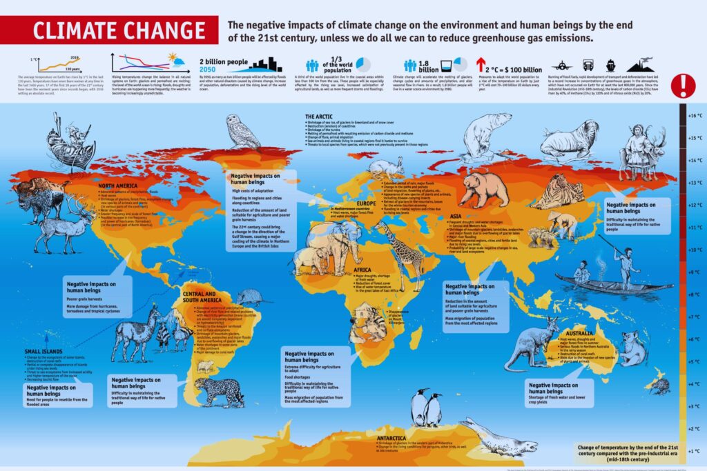
Climate change is significantly altering the dynamics of flood plains, introducing new challenges and exacerbating existing risks. As global temperatures rise and weather patterns become more unpredictable, the intricate balance of floodplain ecosystems and the vulnerability of communities residing in these areas are profoundly affected. Here are the key impacts of climate change on floodplain dynamics:
1. Increased Frequency and Intensity of Flooding
One of the primary impacts of climate change on flood plains is the heightened frequency and intensity of flooding events. Changes in precipitation patterns, more intense storms, and altered hydrological cycles contribute to more frequent and severe floods. This increased variability challenges the resilience of floodplain ecosystems and poses greater risks to human settlements.
2. Altered River Flow and Hydrological Patterns
Climate change influences river flow and hydrological patterns, impacting the natural processes within flood plains. Changes in precipitation and snowmelt timing can disrupt the traditional seasonal flooding cycles, affecting sediment transport, nutrient deposition, and the overall functioning of floodplain ecosystems.
3. Shifts in Vegetation and Ecosystem Composition
Rising temperatures and changing precipitation patterns prompt shifts in vegetation and ecosystem composition within flood plains. Species that were historically well-adapted to specific flood regimes may struggle to survive, while new, more resilient species may dominate. These changes can have cascading effects on biodiversity and ecosystem services.
4. Increased Soil Erosion and Sediment Transport
Extreme weather events associated with climate change, such as intense rainfall and storms, contribute to increased soil erosion and sediment transport within river systems. This elevated sediment load affects the dynamics of flood plains, altering their topography, nutrient content, and overall suitability for vegetation and agriculture.
5. Sea Level Rise and Coastal Flood Plains
For flood plains located in coastal areas, sea level rise is a direct consequence of climate change. Rising sea levels exacerbate flooding in coastal flood plains, leading to saltwater intrusion, loss of freshwater resources, and increased vulnerability for coastal communities. The synergy of riverine and coastal flooding amplifies the risks associated with climate-induced changes.
6. Impact on Migratory Patterns and Wildlife Habitats
Climate change disrupts the migratory patterns of wildlife dependent on floodplain ecosystems. Alterations in flooding regimes affect the availability of suitable habitats for breeding, feeding, and resting. This disruption can lead to population declines, changes in species distributions, and potential ecosystem imbalances.
7. Threats to Agricultural Productivity
Flood plains have historically been fertile areas supporting agriculture, but climate change introduces threats to agricultural productivity. Unpredictable flood patterns, changes in precipitation, and increased risk of extreme weather events pose challenges to traditional farming practices, requiring adaptation and resilient agricultural strategies.
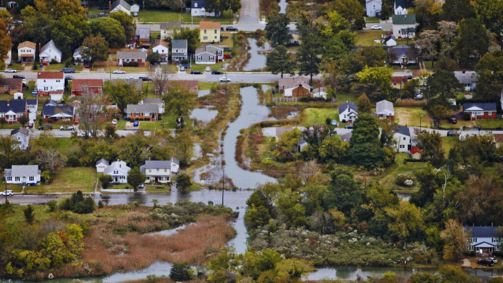
8. Impact on Human Settlements and Infrastructure
Climate change poses direct risks to human settlements in flood plains. More frequent and intense floods can lead to inundation, property damage, and displacement of communities. Existing infrastructure, such as roads, bridges, and buildings, may face increased risks of damage, necessitating adaptive engineering solutions and improved resilience measures.
9. Challenges to Flood Management Strategies
Climate change introduces challenges to traditional flood management strategies. Historical data may no longer accurately predict future flood patterns, making it challenging to plan and implement effective flood control measures. Adaptive strategies that account for the dynamic nature of climate-induced changes become essential for sustainable floodplain management.
10. Increased Risk of Compound Events
Climate change enhances the likelihood of compound events, where multiple extreme weather events occur simultaneously or sequentially. For flood plains, this could mean a combination of heavy rainfall, storm surges, and river flooding, amplifying the overall impact and complexity of managing such events.
Addressing the impact of climate change on floodplain dynamics requires a comprehensive, interdisciplinary approach. This includes adaptive management strategies, sustainable land-use planning, community engagement, and global efforts to mitigate the root causes of climate change. As climate change continues to unfold, proactive and collaborative measures are essential to enhance the resilience of both natural ecosystems and human communities in flood plains.
Conclusion
In conclusion, understanding how flood plains form is not just an academic pursuit but a crucial aspect of mitigating risks and harnessing the benefits of these dynamic landscapes. As we delve into their formation, let’s appreciate the delicate balance between nature’s forces and human interventions.
Read also: How to Get Your Period in One Hour: A Comprehensive Guide
FAQs
Are Flood Plains Dangerous to Live In?
Living in flood-prone areas poses risks, but with proper planning and infrastructure, communities can coexist safely.
Can Flood Plains Be Prevented?
While floods are natural occurrences, certain measures can be implemented to minimize their impact on flood plains.
What Role Do Wetlands Play in Flood Plains?
Wetlands are integral components of flood plains, acting as natural buffers and enhancing the ecological balance.
Do Flood Plains Always Flood?
While periodic flooding is inherent, the severity varies. Proper planning considers and mitigates these natural events.
Are Flood Plains Good for Agriculture?
Flood plains offer fertile soil, making them ideal for agriculture, but proper management is crucial to balance the benefits and risks.
How Can Individuals Contribute to Flood Plain Conservation?
Promoting awareness, supporting sustainable practices, and advocating for responsible development are ways individuals can contribute to floodplain conservation.


Harmoni Rhodes